.png)

Aspen Acres Fire Containment Rises to 48% as Crews Defend Rye and San Isabel
Description: The Aspen Acres Fire remains at 99,820 acres and is now 48% contained as crews defend Rye and San Isabel, improve firelines and begin rehabilitation work...
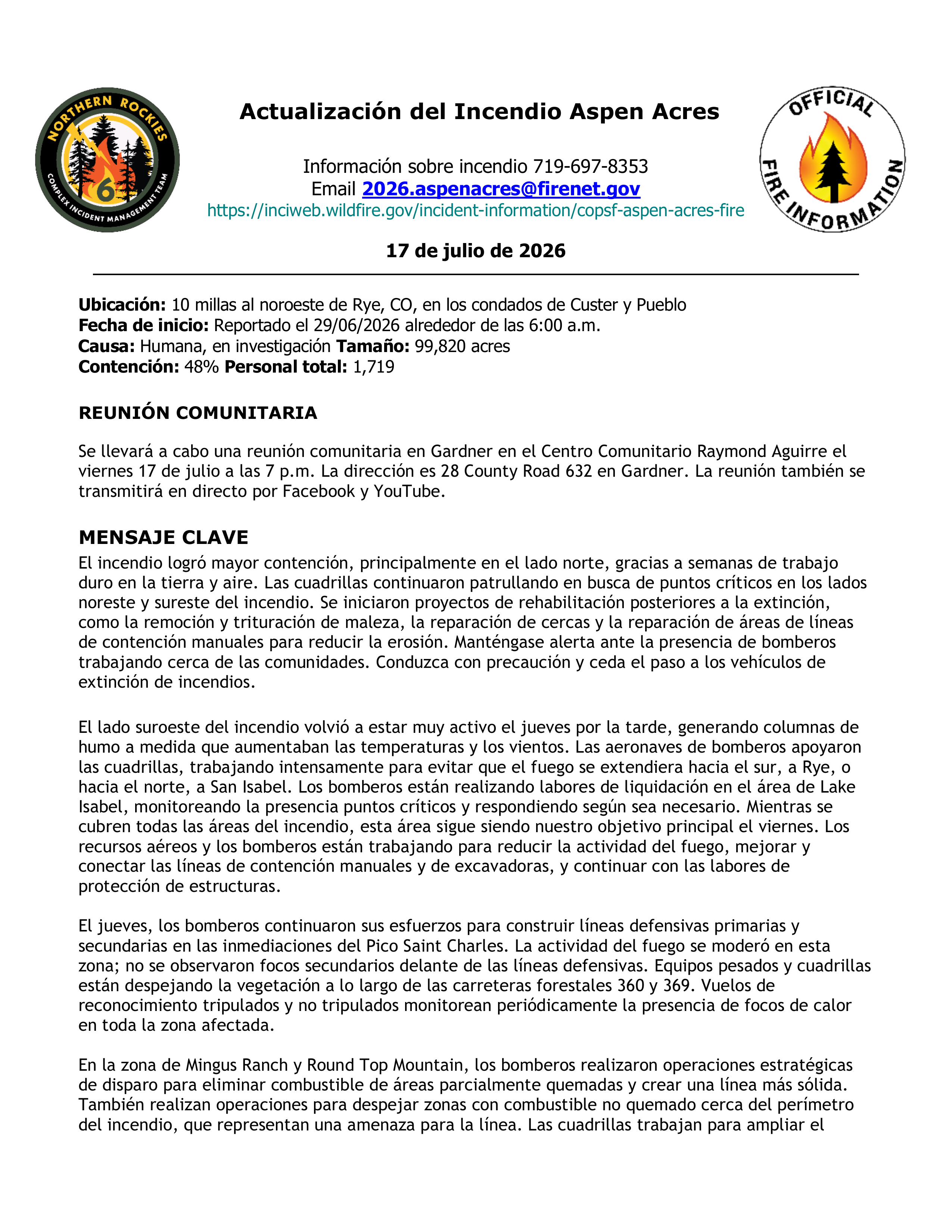
Aspen Acres Fire Update for 7/17/2026 English and Spanish
Location: 10 Miles NW of Rye, CO in Custer and Pueblo Counties
Start Date: Reported 06/29/2026 around 6:00 a.m.
Cause: Human, Under Investigation Size: 99,820 acres
Containment: 48% Total Personnel: 1,719
COMMUNITY MEETING
A community meeting will be held in Gardner at the Raymond Aguirre Community Center on Friday, July 17, at 7 p.m. The address is 28 County Road 632 in Gardner. The meeting will also be broadcast live on Facebook and YouTube.
KEY MESSAGE
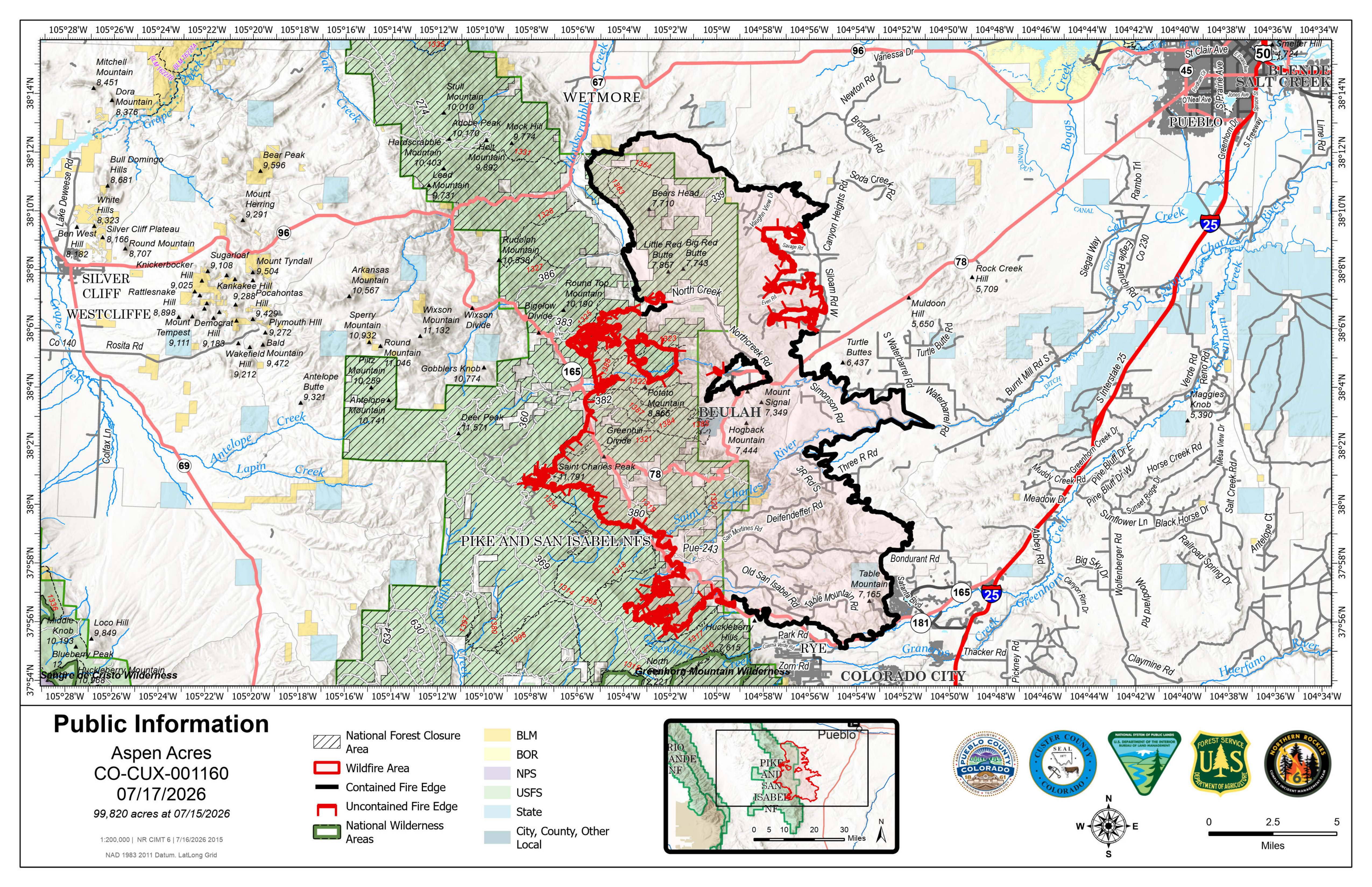
Containment increased on the fire, predominantly on the north side, results of weeks of hard work on the ground and in the air. Crews continued to patrol for hot spots on the northeast and southeast sides of the fire. Post-suppression rehabilitation projects are beginning, such as removing and chipping brush, repairing fences, and repairing handline areas to reduce erosion concerns. Be vigilant for firefighters working near communities. Please drive carefully and yield to firefighting traffic.
The southwest side of the fire was highly active again on Thursday afternoon, producing smoke plumes as temperatures rose and winds increased. Firefighting aircraft supported crews and equipment on the ground, aggressively working to keep the fire from pushing south to Rye or north to San Isabel areas. Firefighters are mopping up in the Lake Isabel area, or monitoring for hot spots and responding as needed. While staffing all areas of the fire, this area remains our primary objective on Friday. Air resources and firefighters are working to reduce fire activity, improve and connect dozer lines and hand lines, and continue structure protection work.
Firefighters continued efforts to construct primary and secondary defensive lines in the vicinity of Saint Charles Peak on Thursday. Fire activity was moderated in this area on Thursday; no spotting ahead of defensive lines was observed in this area. Heavy equipment and crews are clearing vegetation along Forest Roads 360 and 369. Crewed and uncrewed reconnaissance flights routinely monitor for heat throughout the fire area.
In the Mingus Ranch and Round Top Mountain area, firefighters conducted strategic firing operations to remove fuels from partially burned areas to create a more defensible line. They are also firing to clear unburned pockets of fuels near the fire perimeter which also pose a threat to the line. Crews are working to improve the width of firelines, mopping up from strategic firing operations in this area, or searching for and extinguishing heat.
WEATHER AND FIRE BEHAVIOR
Scattered showers were in the vicinity of the fire overnight, but no moisture fell in the fire area. Hot, dry, windy conditions are forecast to persist in the fire area on Friday, with conditions similar to recent days, including a chance of afternoon thunderstorms. As temperatures and winds increase in the afternoon, fire activity is expected to increase on the west side of the fire, posing threats similar to fire behavior observed on Wednesday and Thursday. Fuels remain extremely receptive to fire.
AREA CLOSURE
There is an Aspen Acres Fire Area Closure for the San Carlos Ranger District. Visit: https://www.fs.usda.gov/r02/psicc/alerts/aspen-acres-fire-area-closure . Please monitor land managing agencies for other fire restrictions. The National Forest Lands are closed and are also in evacuation status.
There is a Temporary Flight Restriction (TFR) in place above the fire area. Flying any aircraft within the TFR is prohibited. This includes the use of drones, or unmanned aerial systems.
EVACUATIONS
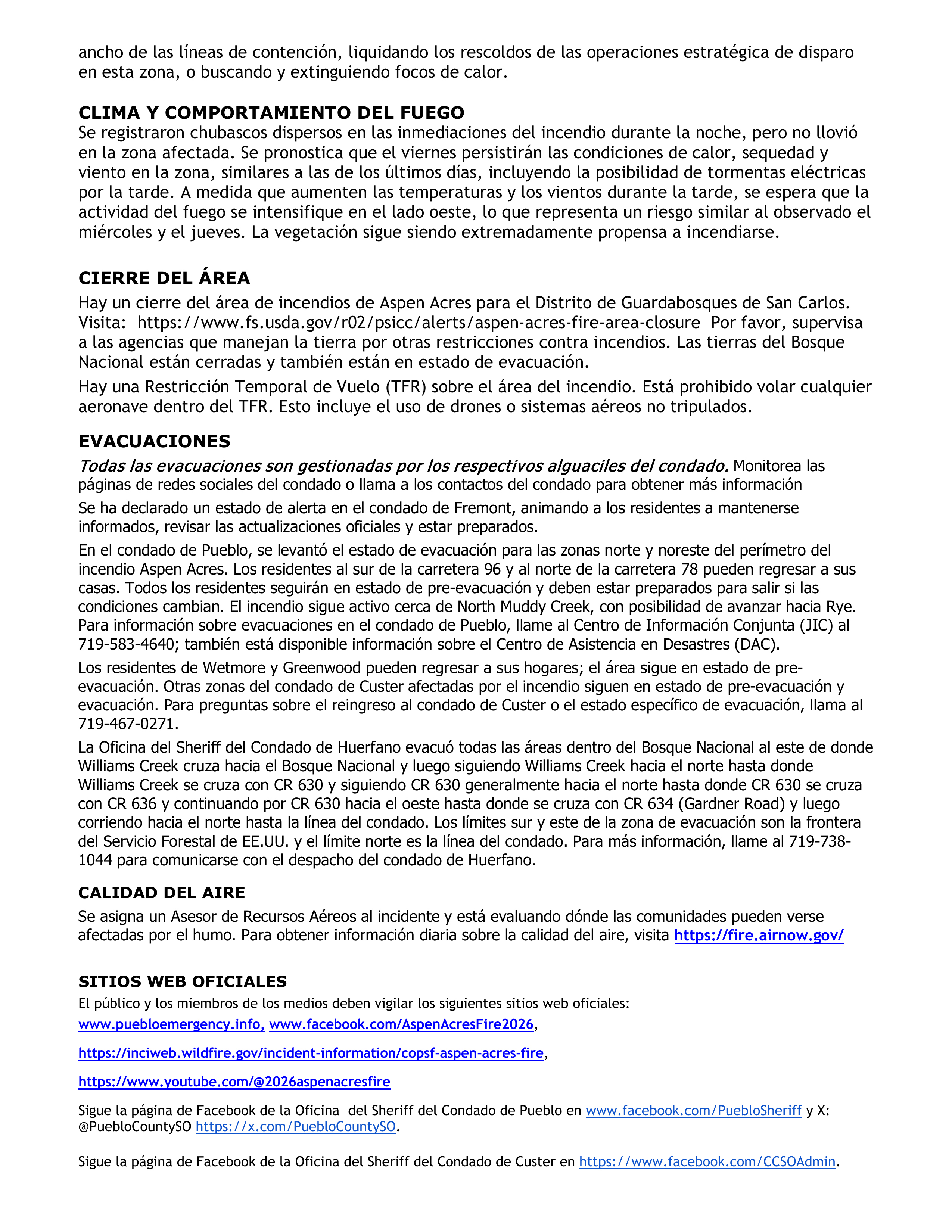
All evacuations are managed by the respective county sheriffs. Monitor county social media pages or call county contacts for more information.
An awareness status is in place for Fremont County, encouraging residents to stay informed, monitor official updates, and remain prepared.
In Pueblo County, evacuation status has been lifted for the north and northeastern portions of the Aspen Acres Fire perimeter. Residents south of Highway 96 and north of Highway 78 are allowed to return to their homes. All residents will remain in pre-evacuation status and must be prepared to leave should conditions change. The fire remains active near North Muddy Creek, with potential to advance toward Rye. Thus, evacuation status remains on the south side of the fire, with Colorado City remaining in pre-evacuation status. For Pueblo County evacuation information, call the Joint Information Center (JIC) at 719-583-4640; information about the Disaster Assistance Center (DAC) is also available.
Wetmore and Greenwood areas remain in pre-evacuation status. The area from Mackenzi Junction Highway 165 south to South Hardscrabble Road opens for residents with Rapid Tag re-entry cards on Friday, July 17 at 9 a.m. Other areas of Custer County affected by the fire remain in pre-evacuation and evacuation status. For Custer County re-entry questions or specific evacuation status, call 719-467-0271.
Huerfano County Sheriff's Office evacuated all areas within the National Forest to the East of where Williams Creek crosses into the National Forest and then following Williams Creek North to where Williams Creek intersects with CR 630 and following CR 630 generally north to where CR 630 intersects with CR 636 and continuing to follow CR 630 west to where it intersects with CR 634 (Gardner Road) and then running due North to the County Line. Southern and Eastern boundaries of the evacuation zone are the US Forest Service boundary and the Northern boundary is the County Line. An area to the east is in pre-evacuation status, which is southwest of County Road 630, southeast of the county line, and north of the national forest boundary. For further information, call 719-738-1044 to reach Huerfano County dispatch.
AIR QUALITY
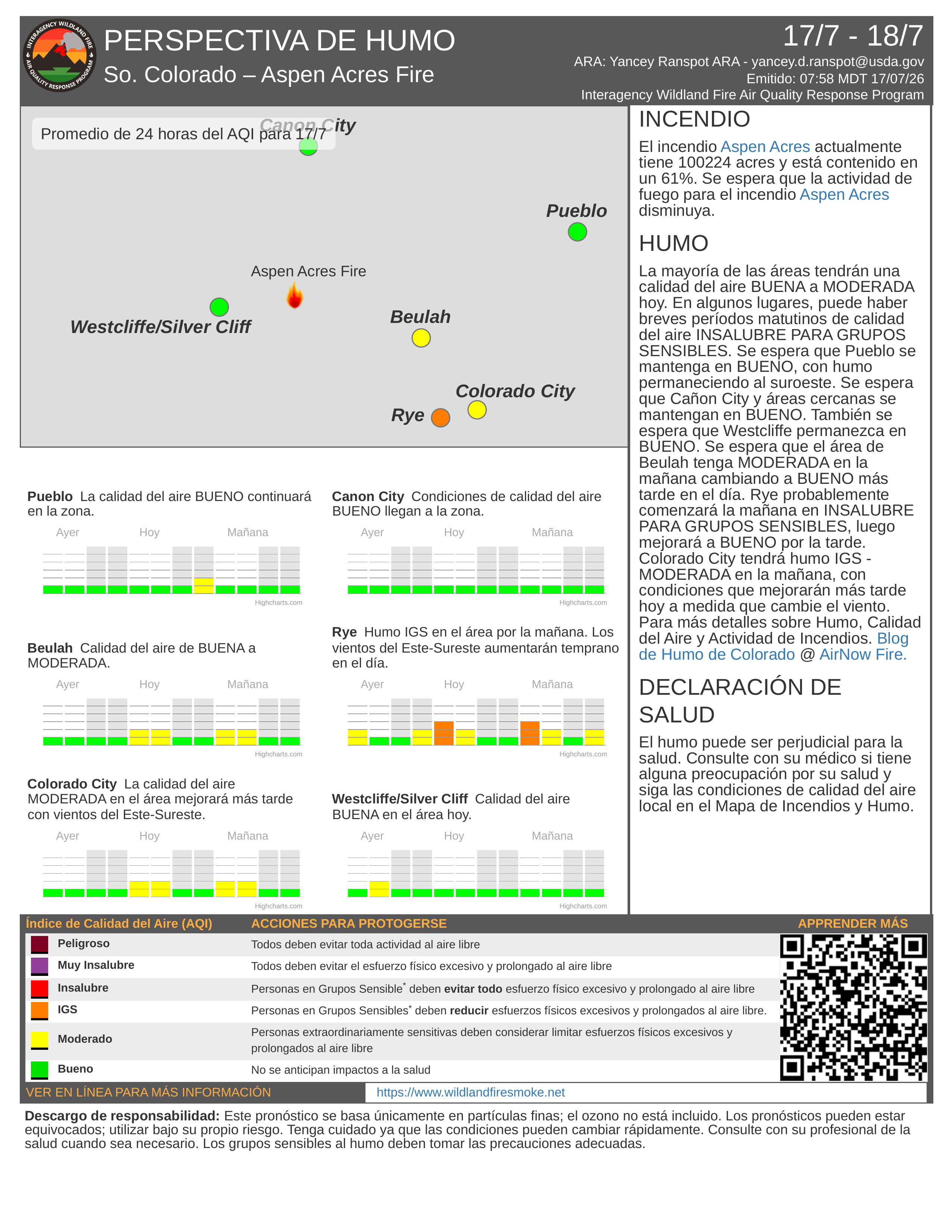
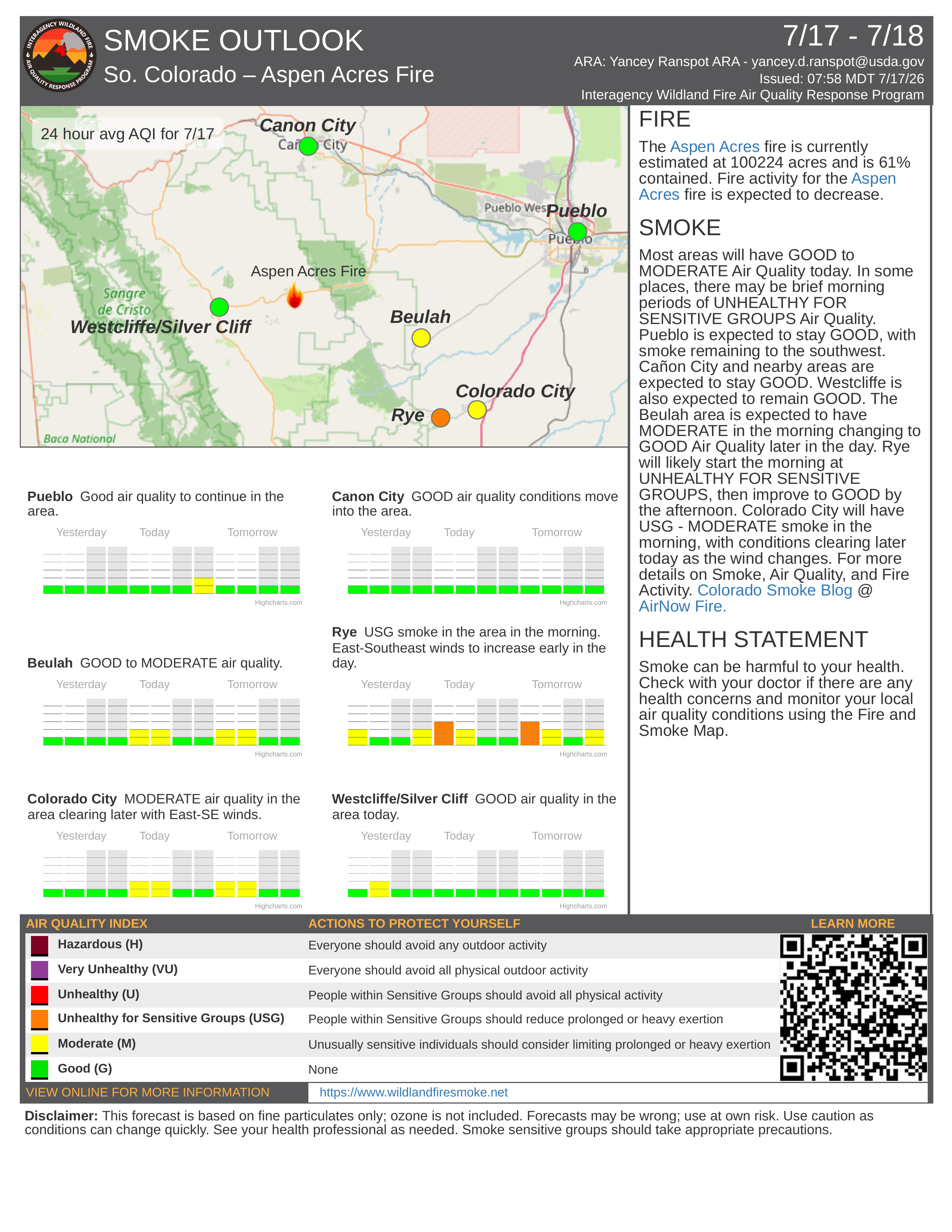
An Air Resource Advisor is assigned to the incident and assessing where communities may be impacted by smoke. To get daily air quality information, visit https://fire.airnow.gov/
OFFICIAL WEBSITES
The public and members of the media should monitor the following official websites:
Follow Pueblo County Sheriff's Office Facebook at www.facebook.com/PuebloSheriff and X: @PuebloCountySO https://x.com/PuebloCountySO.
Follow Custer County Sheriff's Office Facebook at https://www.facebook.com/CCSOAdmin.

Image Gallery